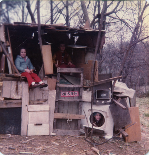
 On the first of May, 1977, at latitude 38.893036 and longitude 77.10101, expedition member Ken Mayer came into the view of a camera lense. The 3-story monstrosity was built from scrap found along the I-66 right-of-way, where torn down houses and businesses along the former railroad line provided plenty of materials.
"I often feel that city-planners fail to recognize the need for free spaces for kids to create their own stuff. In our case, a 20-year fight over an interstate highway created a great over-grown no-man's-land of ruins and forest" says Mayer in a retrospective comment. Although clearly marked "Private", the remains of the hut are now buried below the highway, waiting to be rediscovered.
This comment has been removed by a blog administrator.
ReplyDelete